Main Menu
Blue carbon projects focus on the storage and sequestration of carbon in coastal vegetation, such as mangroves and seagrasses, with the aim of promoting carbon removal and/or emissions reduction in coastal and intertidal ecosystems. These projects typically fall into three categories: (1) conservation (avoided conversion), (2) restoration, and (3) improved management and resource use.
A range of established standards and methodologies exists, alongside a growing number of new, specialized ones, all providing guidance and a framework for project assessment. Regardless of the specific standard or methodology applied, all blue carbon projects follow a step-by-step process: starting with feasibility assessment and, if viable, progressing to project development, validation, and registration (usually involving projections of expected carbon benefits), followed by Monitoring, Reporting, and Verification (MRV), which typically confirms actual carbon outcomes.
This presentation offers a concise overview of intervention types, both established and emerging standards and methodologies, and the key phases and components of blue carbon projects. It then presents a global snapshot of blue carbon projects, categorized by intervention type and standard. Finally, the presentation takes a closer look at blue carbon initiatives in Senegal and identifies currently untapped opportunities for further project development.

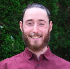
Andrew Butt is a Forest Carbon Associate at TAYO Climate Partners, based in Vancouver, Canada. He has five years of experience in project management, geospatial analysis, carbon quantification, and land use and land cover mapping. At TAYO, he supports the development and management of forest carbon projects that promote sustainable solutions for climate change mitigation.
Andrew holds a Master’s degree in Geomatics for Environmental Management (MGEM) and a Bachelor’s degree in Geography with a specialization in Environment and Sustainability, both from the University of British Columbia. These qualifications underpin his technical expertise in environmental management and geospatial technologies.
Throughout his career, Andrew has contributed to a wide range of carbon projects globally, including afforestation/reforestation (ARR), reducing emissions from deforestation and forest degradation (REDD), improved forest management (IFM), and agricultural land management (ALM). He has worked closely with government agencies, NGOs, and private sector partners.

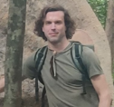
Trevor brings 20 years of experience using geospatial data and field measurements to study and manage forests across Africa, Asia, North America, and South America. In collaboration with the marine conservation NGO Blue Ventures, Trevor played a key role in launching and managing the Blue Forests project in Madagascar (2011–2015). This work led to several firsts: the earliest comprehensive estimates of Madagascar’s total mangrove carbon stock, the country’s first loss-on-ignition soil analysis facility (established at the University of Antananarivo), and the creation of the flagship blue carbon project Tahiry Honko Plan Vivo, as well as the development of the Google Earth Engine Mangrove Mapping (GEM) methodology.
Beyond his extensive work in and around Madagascar’s mangroves, Trevor also contributed to blue carbon ecosystem studies in the United Arab Emirates (UAE) between 2013 and 2015. His work in mangrove ecosystems has included establishing hundreds of forest inventory and classification reference plots, guiding the installation of surface elevation tables (SETs), and pioneering new approaches that leverage emerging tools, data, and technologies for mapping and monitoring.
From 2018 to 2024, Trevor worked with Ostrom Climate Solutions, contributing to a wide range of forest carbon projects in diverse ecosystems — from mangrove swamps to mountain summits — around the globe.